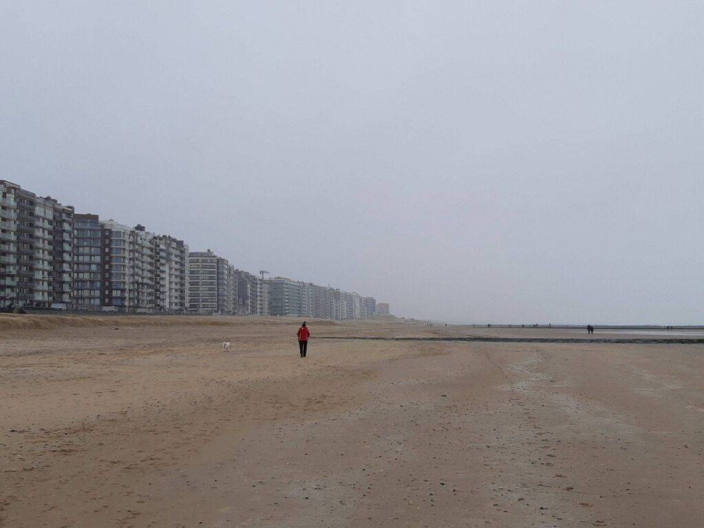
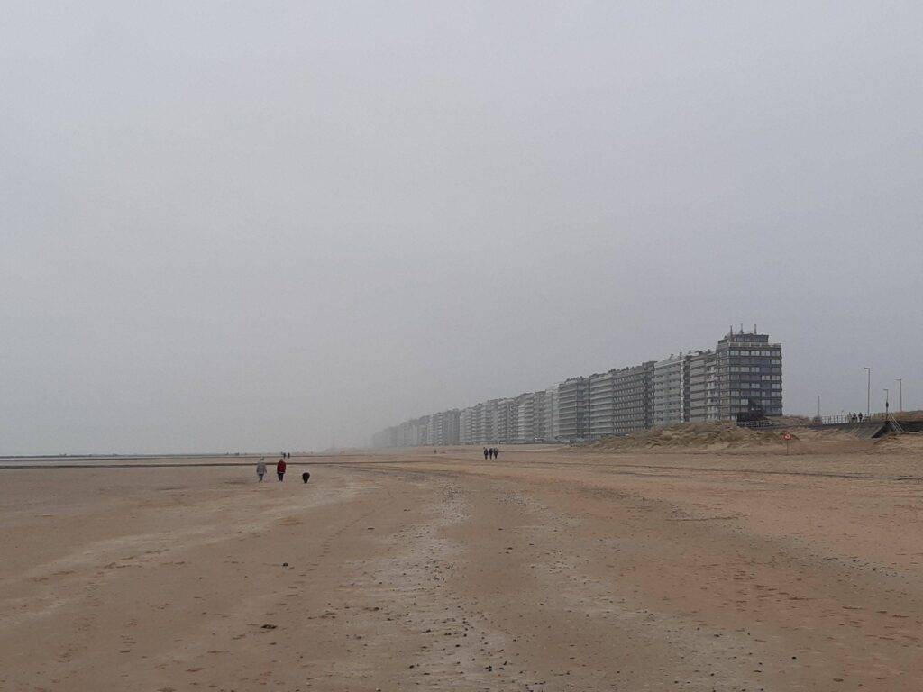
I am writing this article on a typical autumn day with low degrees but a lot of rain. The perfect vibe to talk about a lost island for the coast of Belgium (Europe). The inspiration came after a walk on the beach of the coast town Middelkerke in Belgium, the place where the island Testerep disappeared hundreds of years ago.
Testerep: meaning of the name
Let’s start with the name of the drowned island, namely Testerep. Just like myself, many others will find this a peculiar name. And that’s not strange, because it’s a corruption of an old expression.
The name has existed since the 5th-6th century, in the period of the early Middle Ages. It is believed to come from West Flemish, ‘het is erop,’ as Testerep referred to an elevated landscape.
In colloquial language, Testerep was also called ‘Ter Streep.’

Testerep: an island and peninsula
But what is Testerep actually? Well, in short, you can call it an island. That’s how it originated in the 5th-6th century. It was a sandy island located off the Belgian North Sea coast, between what is now Nieuwpoort and Bredene, and in front of Oostende, Westende, and Middelkerke. Especially the latter three seaside resorts have a direct link to Testerep, but I’ll tell you more about that below.
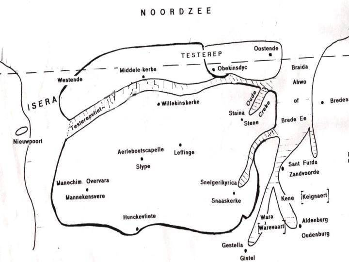
Below, you can see an old map of the Belgian coast, where the situation with the island of Testerep and the mainland is clearly recognizable.

How could an island arise off the Belgian coast? Well, in the early Middle Ages, there were no breakwaters as we know them today. They were only introduced later to literally break the waves, reducing the impact on the beach. This also means that the beach looked very different in the Middle Ages. It suffered more from the tides of ebb and flow and had a rougher appearance than the often flat, protected tourist beaches we know today. You could even compare the medieval beach in Belgium to a tidal coast, as seen in the Netherlands, or the region around the Delta Works, such as Neeltje Jans.
It was under the forces of these tides that an accumulation of sand occurred over the years. This accumulation eventually became so large and high that it could be called a little island: Testerep. Because the island was not yet high enough and therefore flooded during high tide, it would be a long time before it was inhabited.
In the 10th century, several centuries after its formation, dunes had already formed on Testerep. These dunes protected the island from flooding, making habitation and the development of a real settlement for fishermen and shepherds possible. The counts of Flanders at that time even donated part of a sheep pasture on Testerep to the Saint Peter’s Abbey in Ghent (located at Saint Peter’s Square, not to be confused with St. Bavo’s Cathedral in the old center of Ghent).
Testerep was further developed by humans, including the construction of dikes, and the settlements grew into villages. In the 12th century, a real church was even built in honor of Mary: the Sanctae Mariae de Testreep, which would later be transformed into Mariakerke, another coastal town linked to Testerep.
Testerep and common day coast cities: Raversijde, Bredene, Oostende, Westende, Middelkerke en Mariakerke
I’ve mentioned it a few times already: several seaside resorts are linked to Testerep. I personally find it always interesting to connect contemporary names to their (often forgotten) history. Because place names tell us a lot about the history of our landscape. That’s why I’d like to delve a bit deeper into it.
The most obvious links are Westende, Oostende, and Middelkerke. Westende and Oostende are said to be towns that developed on either side of Testerep. Hence their names: West-ende (the western end) and Oost-end (the eastern end). A fun fact, as Westende and Oostende originated when Testerep still existed but have outlived the island.
Westende beach:

ou can actually consider Oostende as two different cities in history: an old Oostende and a new Oostende that was founded after abandoning Testerep as a settlement.
By now, you can probably guess where Middelkerke was located in relation to Testerep, Oostende, and Westende. It was, as the name suggests, right in the middle!
Furthermore, you also have Mariakerke, originating from the little church on Testerep. Bredene, on the other hand, refers to one of the channels that separated Testerep from the rest of the land: ‘Brede Eede’ (Wide Channel). Additionally, there were settlements like Walraversijde, now known as Raversijde, and Lombardsijde.
Middelkerke beach:

The end of the island of Testerep
However, we can no longer see Testerep. It has long been engulfed by the sea, which is why we refer to it as the drowned island Testerep. The construction of breakwaters added an extra layer of sand, meaning that the remnants of Testerep are now buried about a meter or two under the sand.
But how did Testerep disappear? In the 13th century, Countess Margaret of Flanders granted permission for Oostende to further develop as a city. As a result, part of the dune belt of Testerep was leveled. A dam was also built to close off the western channel, transforming Testerep from an island into a peninsula.
If you recall the first part of this blog post, you’ll remember that this allowed the tides to influence Testerep again. Particularly, storm surges further eroded the naturally formed Testerep. As always, nature and our surroundings evolve, and Testerep underwent this fate as well.
After the St. Vincent’s Flood of 1394, Testerep was abandoned, and the new Oostende was founded inland. In the 15th and 16th centuries, tidal forces would permanently erase the island of Testerep from the sea. Only the southern part of Testerep would remain part of the mainland after reclamation. The current coastline, after examination, roughly corresponds to what was once the southern half of Testerep. So, when you walk along the edge of our Belgian coast between Westende and Oostende, you are walking on a piece of Testerep!
The dissapeared island of Testerep: nowadays
However, we can no longer see Testerep. It has long been engulfed by the sea, which is why we refer to it as the drowned island Testerep. The construction of breakwaters added an extra layer of sand, meaning that the remnants of Testerep are now buried about a meter or two under the sand.
But how did Testerep disappear? In the 13th century, Countess Margaret of Flanders granted permission for Oostende to further develop as a city. As a result, part of the dune belt of Testerep was leveled. A dam was also built to close off the western channel, transforming Testerep from an island into a peninsula.
If you recall the first part of this blog post, you’ll remember that this allowed the tides to influence Testerep again. Particularly, storm surges further eroded the naturally formed Testerep. As always, nature and our surroundings evolve, and Testerep underwent this fate as well.
After the St. Vincent’s Flood of 1394, Testerep was abandoned, and the new Oostende was founded inland. In the 15th and 16th centuries, tidal forces would permanently erase the island of Testerep from the sea. Only the southern part of Testerep would remain part of the mainland after reclamation. The current coastline, after examination, roughly corresponds to what was once the southern half of Testerep. So, when you walk along the edge of our Belgian coast between Westende and Oostende, you are walking on a piece of Testerep!
Source:
Picture sea
Pictues beach: histyrob.com
Picture map


